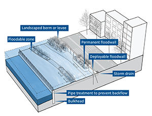
Talk of protecting NYC's shorelines isn't new. After Hurricane Donna in 1960, the Army Corps of Engineers proposed dunes, levees and walls. Click orange areas to explore plans for Staten Island and The Rockaways.
Embedded Staten Island images scanned by WNYC from "Staten Island, New York, Fort Wadsworth to Arthur Kill: cooperative beach erosion control and interim hurricane study," 1964 and "Draft environmental statement: Staten Island, Fort Wadsworth to Arthur Kill, beach erosion control and hurricane protection project, Richmond County, New York," 1976, U.S. Army Corps of Engineers. Copies of those publications were made available courtesy of Dr. Alan Benimoff at the College of Staten Island.
Rockaways image from "Beach erosion control phase of Beach Erosion Control and Hurricane Protection Project: Atlantic coast of New York City from East Rockaway inlet to Rockaway inlet and Jamaica Bay, New York," 1979, U.S. Army Corps of Engineers.
Built with Mapbox and Open Street Maps
Steven Melendez, Joe Geoghan, John Keefe and Louise Ma / WNYC. Follow us @datanews, email us here.
The WNYC Data News Team is part of a public radio station supported by audience contributions. If you like what you see, consider supporting our work.
Talk of protecting NYC's shorelines isn't new. After Hurricane Donna in 1960, the Army Corps of Engineers proposed dunes, levees and walls. Click orange areas to explore plans for Staten Island and The Rockaways.